STS Technoscience Project- Cat GPS Tracking
By:Edwin Jimenez, Justin Wang, Will Payne and Søren Dahl
Introduction:
We are a group of four STS students from NC State University creating a citizen science project.
Traditional citizen science rarely engages participants in shaping the research agenda. On the other hand, civic technoscience affords: “new material technologies in combination with new social and literary technologies that can sustain a civic research space external to the academy and where nonacademic can credibly question the state of things.” “Rather than being short-lived, these communities that blend citizen science with critical making are attempting to establish a formal and lasting presence within domains of scientific research and interface with formal experts.” (Both quotes from Wylie, et al 2014).
In light of this approach to civic technoscience, we have chosen a citizen science project called the Track-Your-Cat research project, which was started by wildlife.org. In this project, we are going to remake and contribute to the research that wildlife has started.
We will have to achieve at least one of the two main goals for the Making Project:
First Goal: Adapt the project so that it can use inexpensive and open source critical making tools rather than proprietary hardware.
Second Goal: Using critical making tools, alter the project in some way (i.e., what the project collects, how often it collects it, etc.) that will potentially improve the project.
————————————————————————————————————————-
The Step-by-Step instructions for the project: How to Track Your Cat
Here’s how you can participate in Cat Tracker:
1. Register by completing a participant questionnaire for each individual cat you want to track and sign the Informed Consent form.
2. Make a GPS harness (must have Windows OS) or obtain a GPS harness (if local to Raleigh/Durham, Fairfield County, CT or Westchester County, NY).
3. Set cat loose for 5 days with the GPS harness safely affixed to your cat. After 5 days, leave harness on your cat, but remove GPS unit and follow provided instructions for downloading and uploading data. Recharge GPS unit and re-program it for a second 5-day tracking period or simply swap out first GPS unit with second unit provided by Cat Tracker.
4. Download and then upload data from GPS (if DIY), or return harness and GPS unit if local to Raleigh/Durham, Fairfield County, CT or Westchester County, NY.
———————————————————————————————————————————————-
Actual project instructions (links):
PDF file with all DIY instruction for creating the GPS harness and working software: http://cats.yourwildlife.org/wp-content/uploads/Written-How-To-Cat-GPS_3…
How To Video:
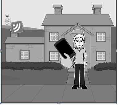
Picture of GPS harness:
The instructional look provided by Wildlife.org(right), our sketch of a prototype(left):


————————————————————————————————————————– Brain Storming Ideas:
Our project
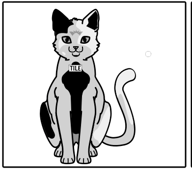
TILE HARNESS:
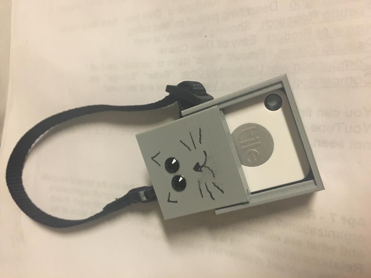
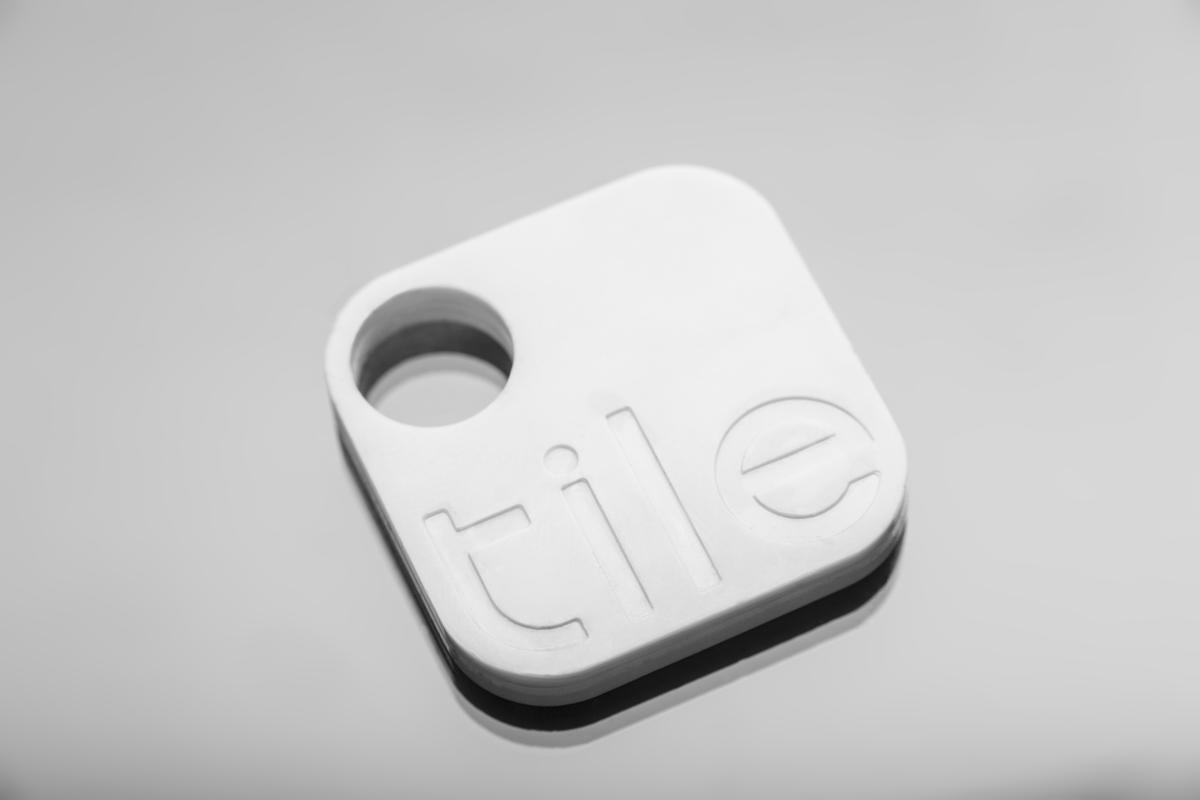
Our first idea was to use a smaller and lighter tracking device that would be harnessed to the cat. Our casing would be 3D printed, making it cheaper and easier to produce than the provided GPS setup. After some research, we found the ”TILE” and thought it would be perfect for this project. The Tile is light enough for the cat to acclimate to it quicker and is easily trackable by phone.
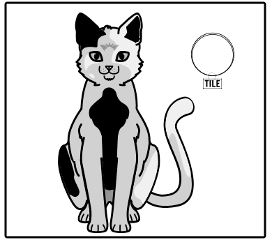
TILE COLLAR:
Our next idea was to format our design to hang around the cat’s neck. Many cats wear a collar with a name tag hanging from it. We thought that if we use that same concept, we would be able to create something that would be more comfortable for the cat, which also took less transition time for the cat to feel comfortable (the original Wildlife.org’s harness had a two-day acclamation time). Also, we found instructional videos on how to make a DIY collar. The TILE would need a waterproof case, which we would be able to 3D print. Then, we would need a smart phone to download the Tile app to track the cat.
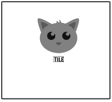
Our Intial sketches:
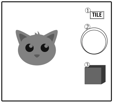
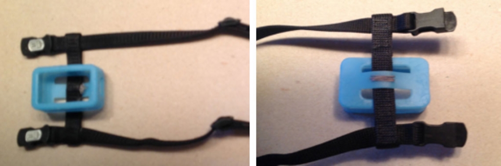
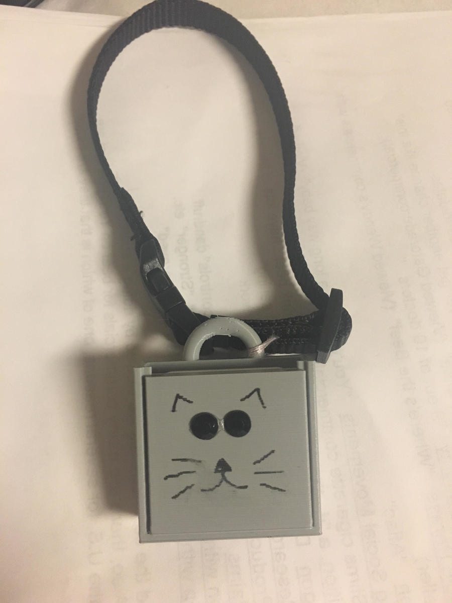
We decided that we liked the idea of having the case come with a case and a lid, as it would be easier to take the Tile in and out of the casing. So we modified our third design from a harness to just a square casing.
RE-MODELED GPS DATA LOGGER IDEA:
Our second idea was to create a cheaper version of the original data logger that was instructed in the Track-your-cat project. Junior Pi School had created a GPS device that they call the GPS Scooter Logger, and it can be built for around $50. The device is actually a simple GPS data logging device. It uses a uBlox GPS receiver and antenna along with an Arduino Mini microcontroller to process the positional data and then write it as a Google Earth. kml file to the attached SD card.
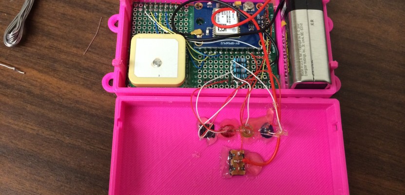
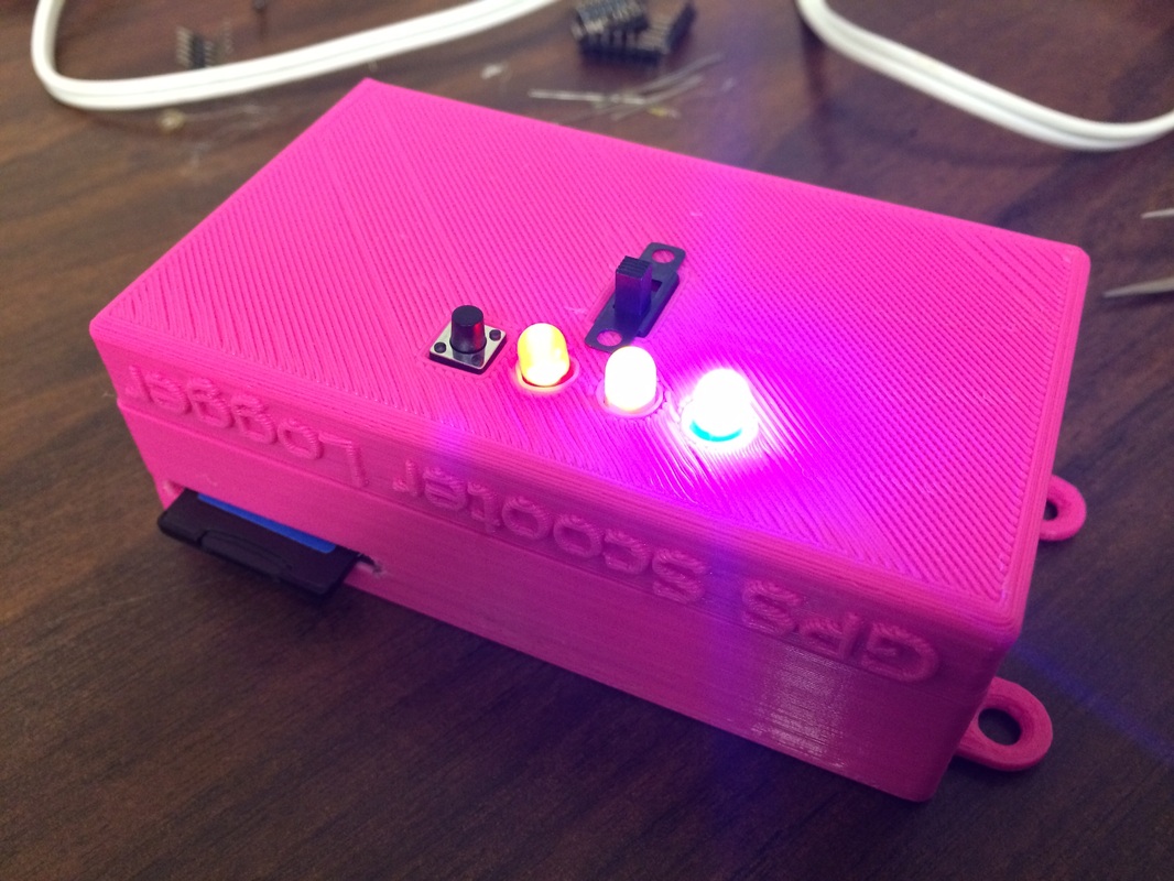
LINK TO PROJECT: http://www.xyht.com/spatial-itgis/low-cost-diy-gps-data-logger/
——————————————————————————————————————————————
ACTUAL PROJECT:
The first step of the project: Signing up and filling out the consent form for the project:
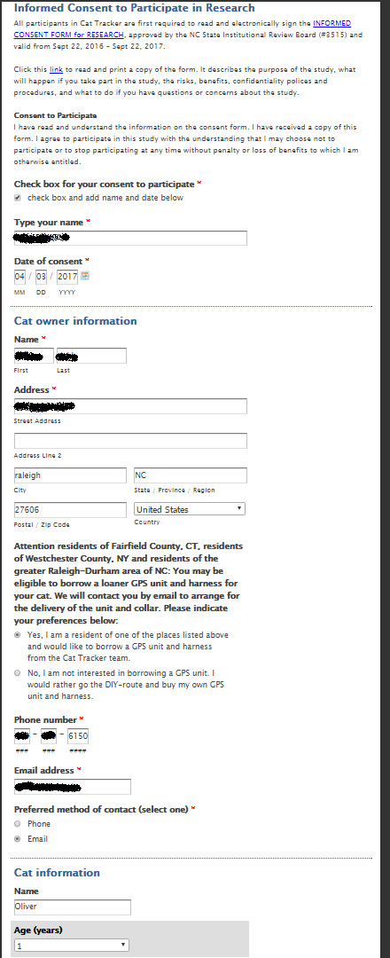

The consent form asked questions about participants (The civic scientist) and also included multiple questions about our cat. All of which can be included in wildlife.org’s research. This part is vital to research, and it’s also an important part to understand when you are using human or animal samples/test groups. We were never able to test the final project on our cat in order to give Wildlife.org our data. But we did confirm that our project not only was cheaper but also more convinient and comfortable for the cat. Below we have shown the creation process.
Step two of the project: Create the GPS Tracking device:
• Which citizen science project have you chosen to adapt? (include link) (5 pts)
We chose to do our own adapted version. We called this the ”GPS COLLAR”.
While brainstorming and looking at the potential pros and cons of our two ideas, we decided
The Collar beat the traditional GPS (DIY build) Harness idea on almost all aspects.
• Why have you chosen this project, and how have you adapted it? (10 pts)
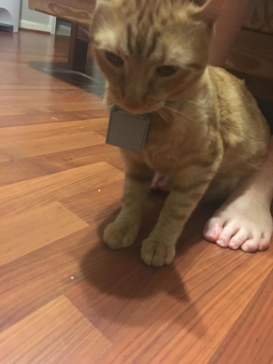
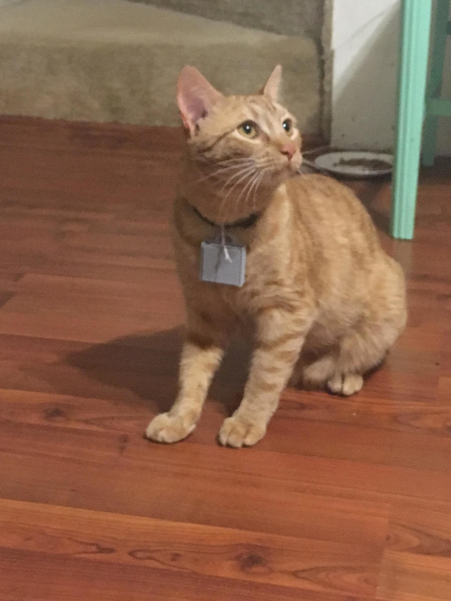
We have chosen this project because it was the least expensive and more open source to create. We think any individual could create and use this concept to track his or her lovely animal, which in this case the aniaml we used was a cat. We have used a Tile to collect data to track the cat. We have 3D print a unique design to house the Tile and place it with a collar aroud the cat’s neck. The cat felt comfortably with the device around it’s neck. Then, the Tile was collecting the data, which we could see with the Tile app we download in a smart phone.
• Document your adaptations with photo, video, and/or code, etc. Was this cheaper, easier, more expensive, more complex? (20 pts)
Looking at the original product design, we noticed the comfort of the cat seemed to have been forgotten. The original product was also expensive and could easily be done cheaper. There was also limited interactions between the cat tracker (us) and the cat. So, we thought we could spice up the project with a more interactional and modern design, where all data was collected instantly on your phone.
The harness and the GPS tracker seemed to big and with a weird design. So, our design emerged out of the observation that most cats were a collar with a name tag hanging from it. The use of a ”TILE” will allow us to have a smaller and lighter tracking device.
Tile:
The weight will be decreased 10folded by using a Tile in comparison to the ”IgotU USB GPS travel and sports logger”.
-The dimensions of the TILE are: 37mm x 37mm x 5.3mm
-The IgotU USB GPS travel and sports logger dimensions: 8 x 6.1 x 8 inches
The TILE also significantly decreased the price of the GPS Tracking device.
-TILE: 25 dollars (https://www.thetileapp.com/store/tiles/mate?defaultproduct=mate-1-pack&gclid=COrW1tKPmtMCFY2LswodEfUM6w&gclsrc=aw.ds&dclid=CPWY7NKPmtMCFZZDNwodm1cOlg)
-IgotU USB GPS travel and sports logger: 69 dollars.(http://www.spytecinc.com/i-gotu-gt-120-gps-logger.html?gclid=CObZlf2PmtMCFZaKswod_vQO4A)
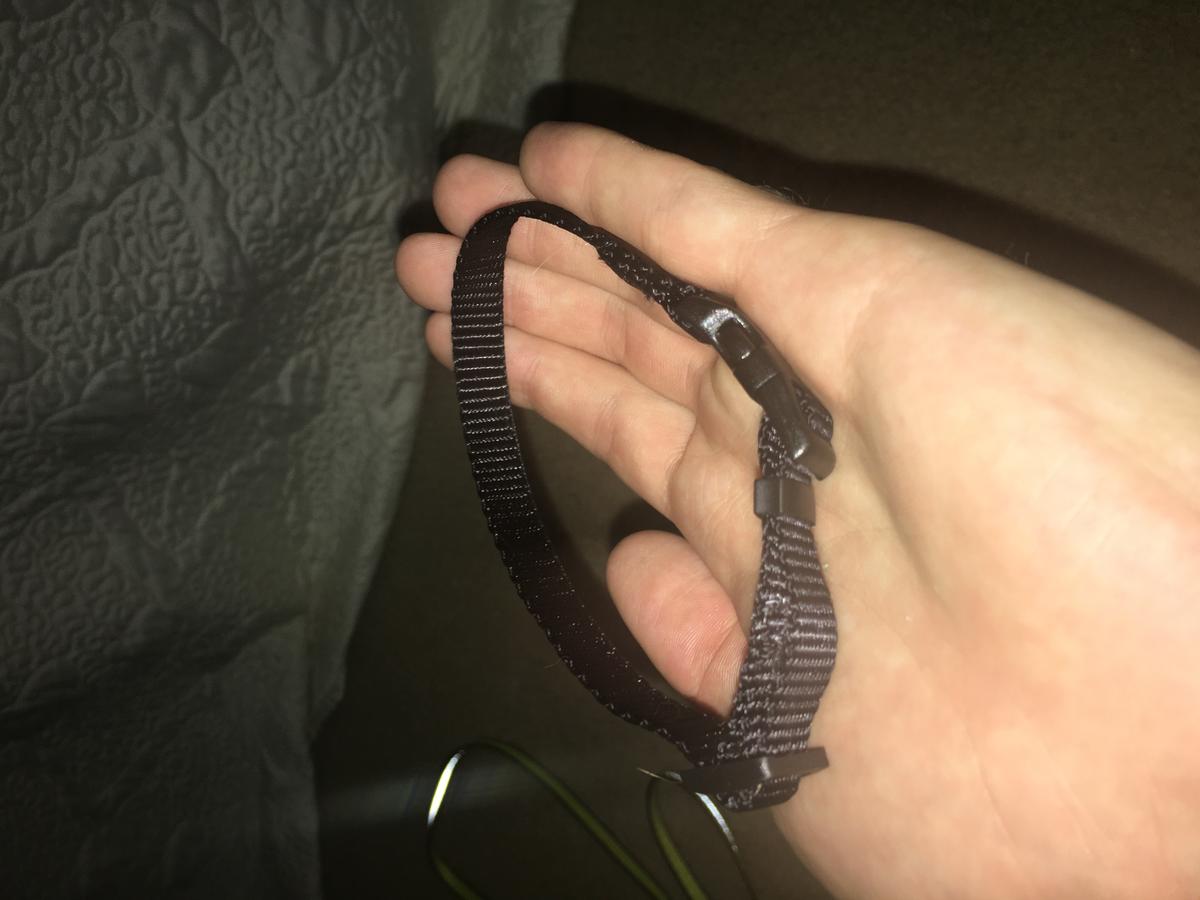
Cat collar:
Instructional video on how to create a cat collar:
We found an easy instructional video on how to create a cat collar. This collar can easily be attached to the
3D printed case for the Tile. The collar choice over a harness will increase the comfort of the cat and decrease the price of the project. We also expect our design to be applicable on the cat instantly and, thereby, delete the 2-day acclamation time the original design had. The collar can be made with almost any kind of fabric(durable) and only need a small amount of sewing. Ligther material will be preferred. The video is extreamly easy to follow, making everyone able to make this collar.
-The Cat-it H style harness: 14 dollars
-DIY cat collar: Estimated at 2 dollars (limited amount of fabric and sewing equipment)
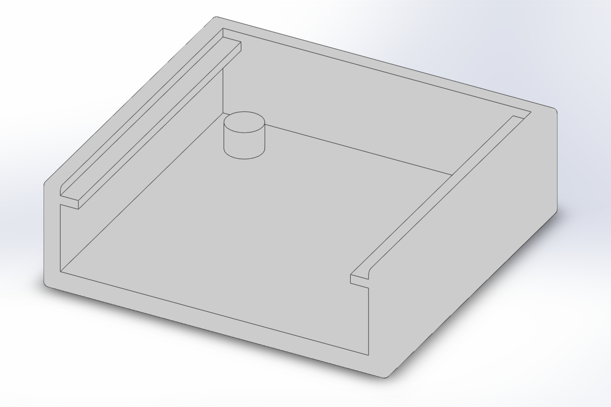
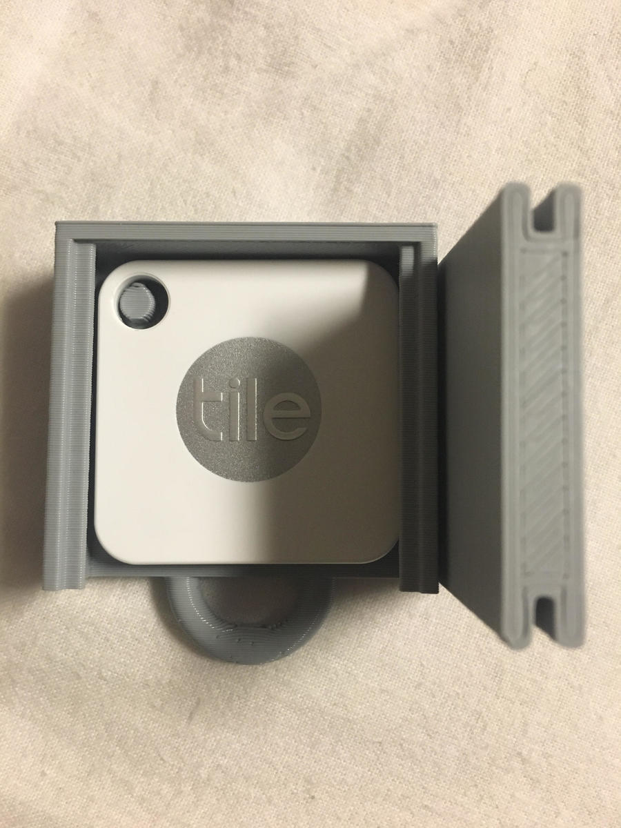
3D printing the case:
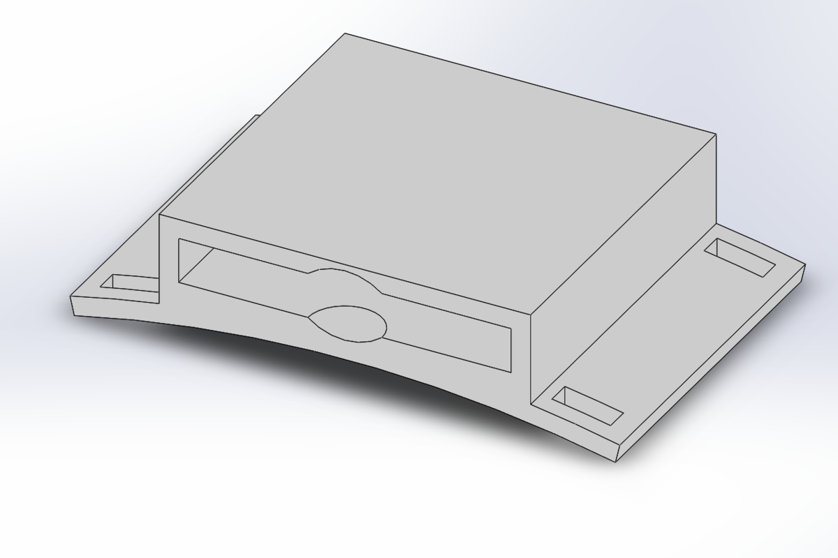
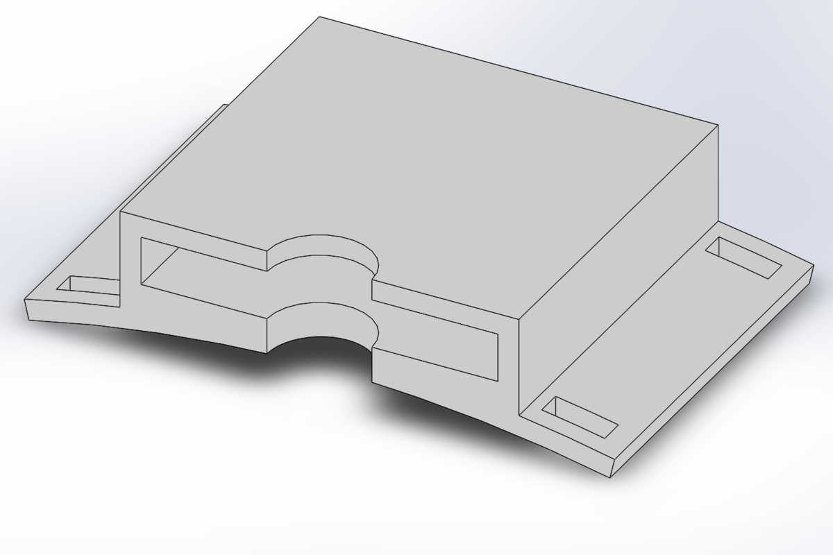
We chose to create a waterproof wilderness case for the Tile. In order to protect the Tile while also making it more durable to the different environments that the cat will meet on its adventures, we designed the case in SolidWorks:
Part files: https://grabcad.com/library/sts214-project-cat-tracker-collar-2
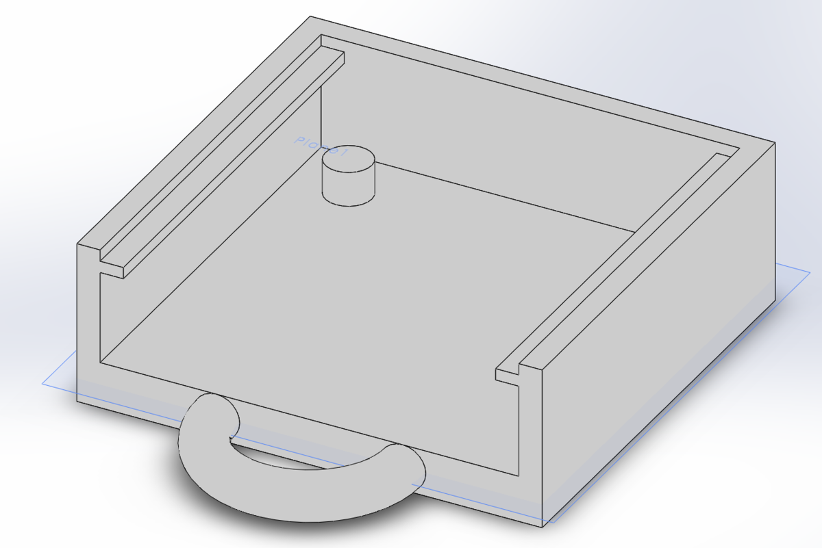
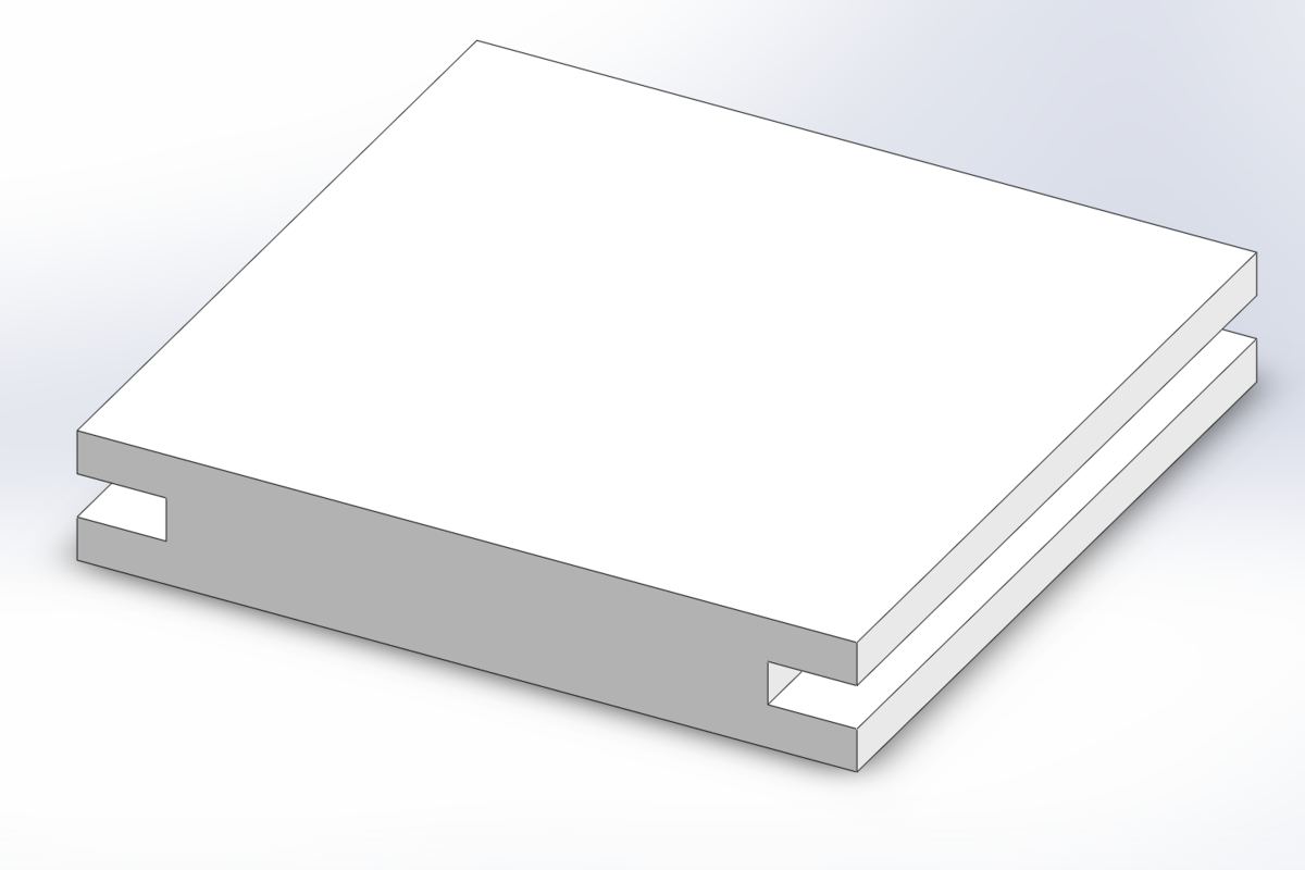
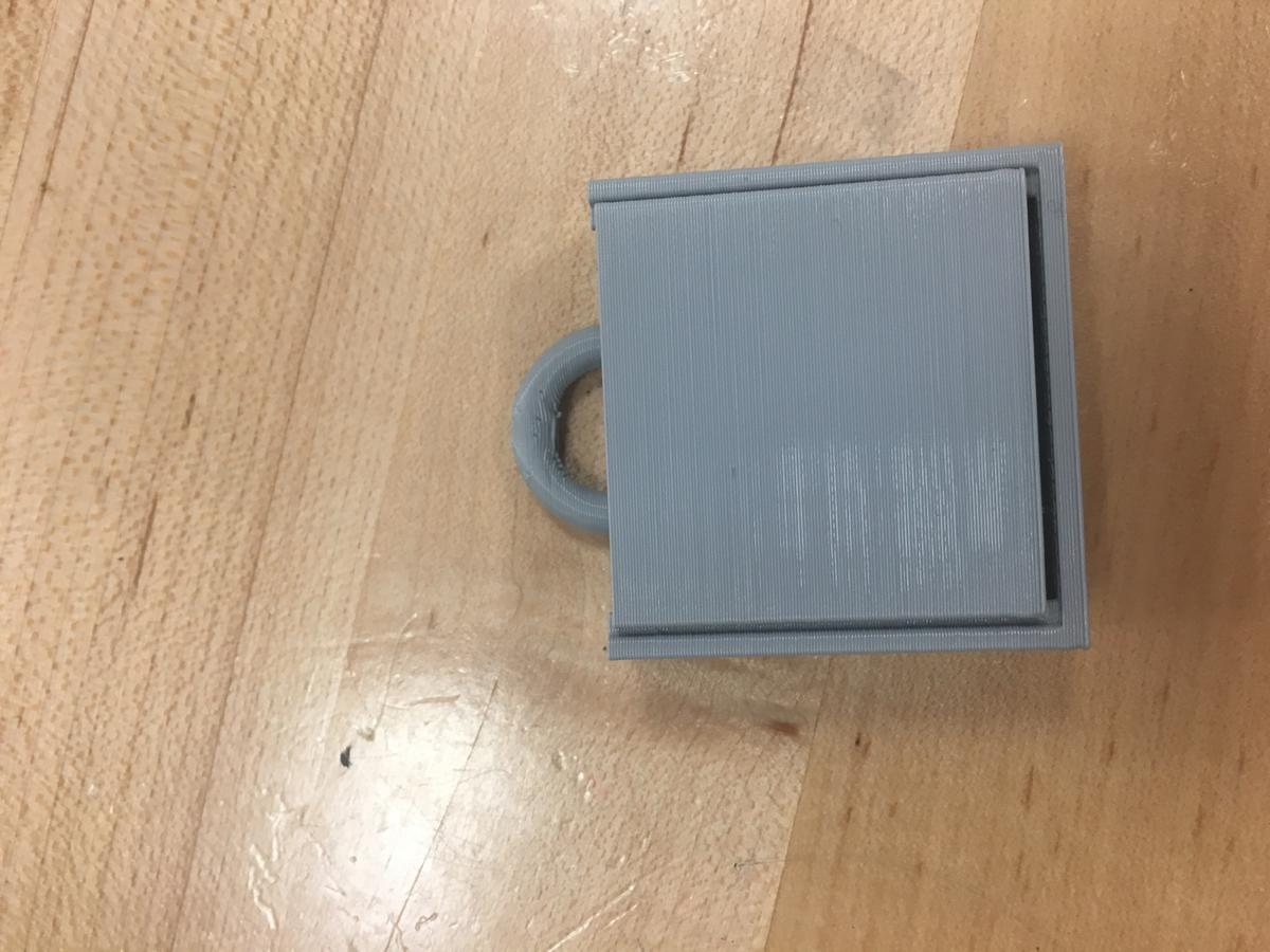
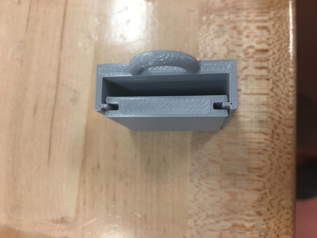
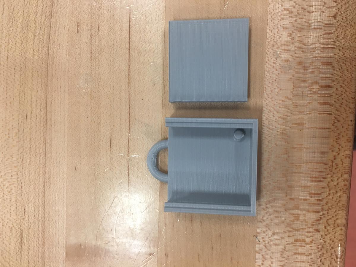
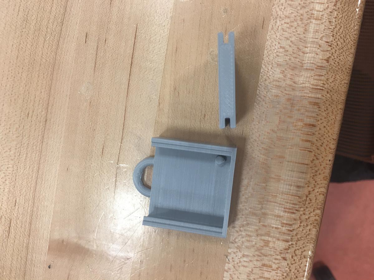
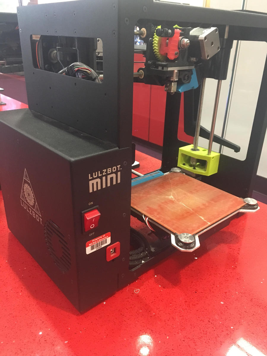
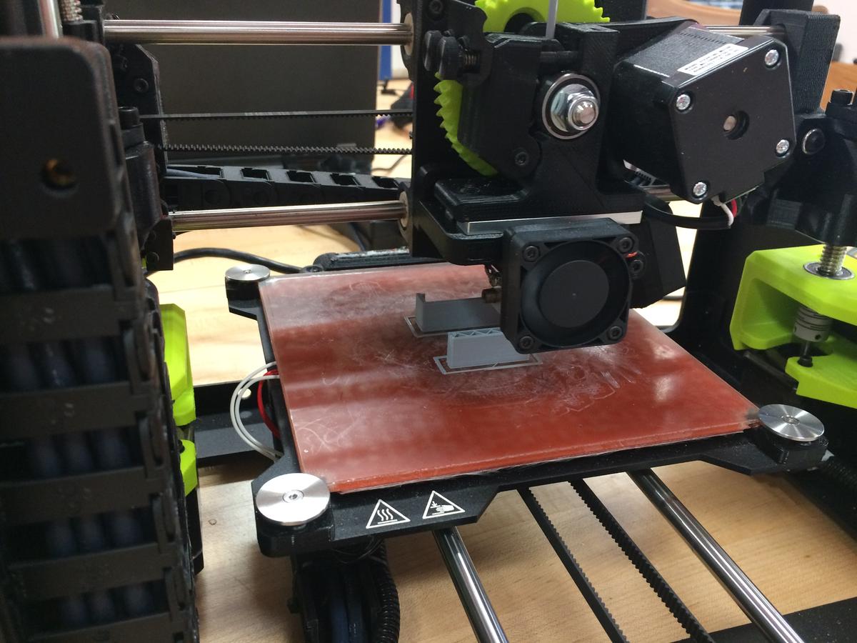
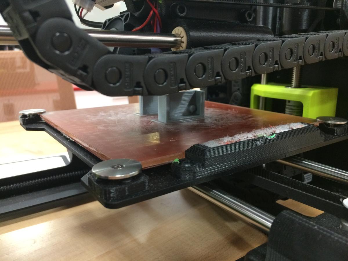
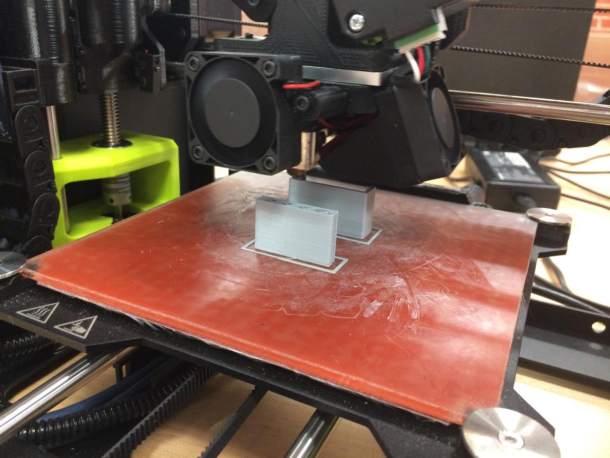
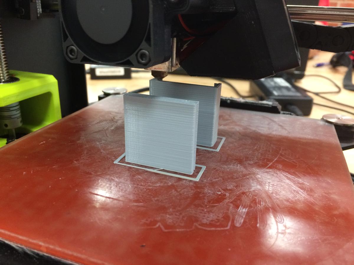
To create our 3D printed design we used the Lulzbot mini in NC State’s Library Makerspace. We purchased $10 worth of PLA 2.85mm filament for printing. Our first few attempts had issues with the lid being too wide for the case or the grooves being too tight to slide snugly into place. However, we eventually reached a design that we were happy with.
Tile App, GPS tracking:
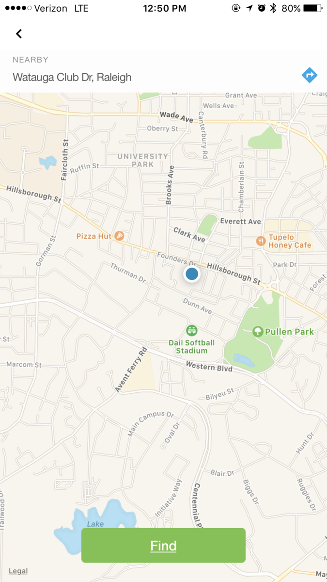
By using the Tile app to track our cat, we are also able to constantly know where our cat is located. This will make the collection of data more interactive with the researcher. The Tile app tracking is only able to give us snap shots of the cat’s location when we check the app. We decided to attach the gps collar to one of us, to test the gps tracking. This photo shows a snap shot of the tile’s location>
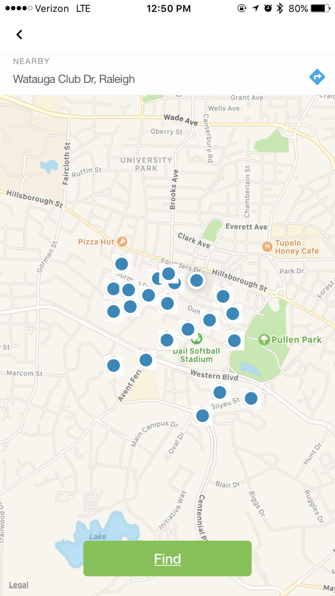
by only getting one snap shot, this meant that the collection of data required more work than the original project. We decided to install a timer that would notify us every 20min for a 4 hour periode, and collect all the data point. This is the map after the 4 hours of tracking>
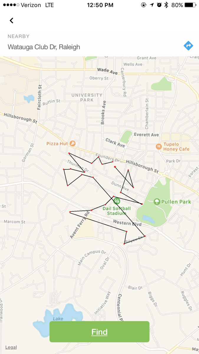
In order to give our data to the researchers at Wildlife.org we converted the picture into data points and got this map>
The final design:
• Was your adaptation successful? Did the project work as expected? Unexpectedly? Remember, this is an experimental project, so it’s ok if things don’t go exactly as planned. Just give an honest evaluation of the project and how it went. (10 pts)
Overall we believe the project was a success! We were able to decrease the cost of the project, while creating a design that increased the comfort of the cat which allowed for a 0 day acclimation period unless your cat does not use a collar. we did expect this to be more work due to the fact that the GPS unit collects information automatically but for the reduction in cost we found it more than worthwhile. We ran into some bumps with the 3D printing as well having to go through 2 iterations before the TILE finally fit.
Decreasing cost:
Original project cost: 69(gps)+12(harness)
Our project cost: 25(tile)+2(collar)+10(3D case)
Total saving from our project: 81-37=44 Dollars
Increasing comfort with new design:
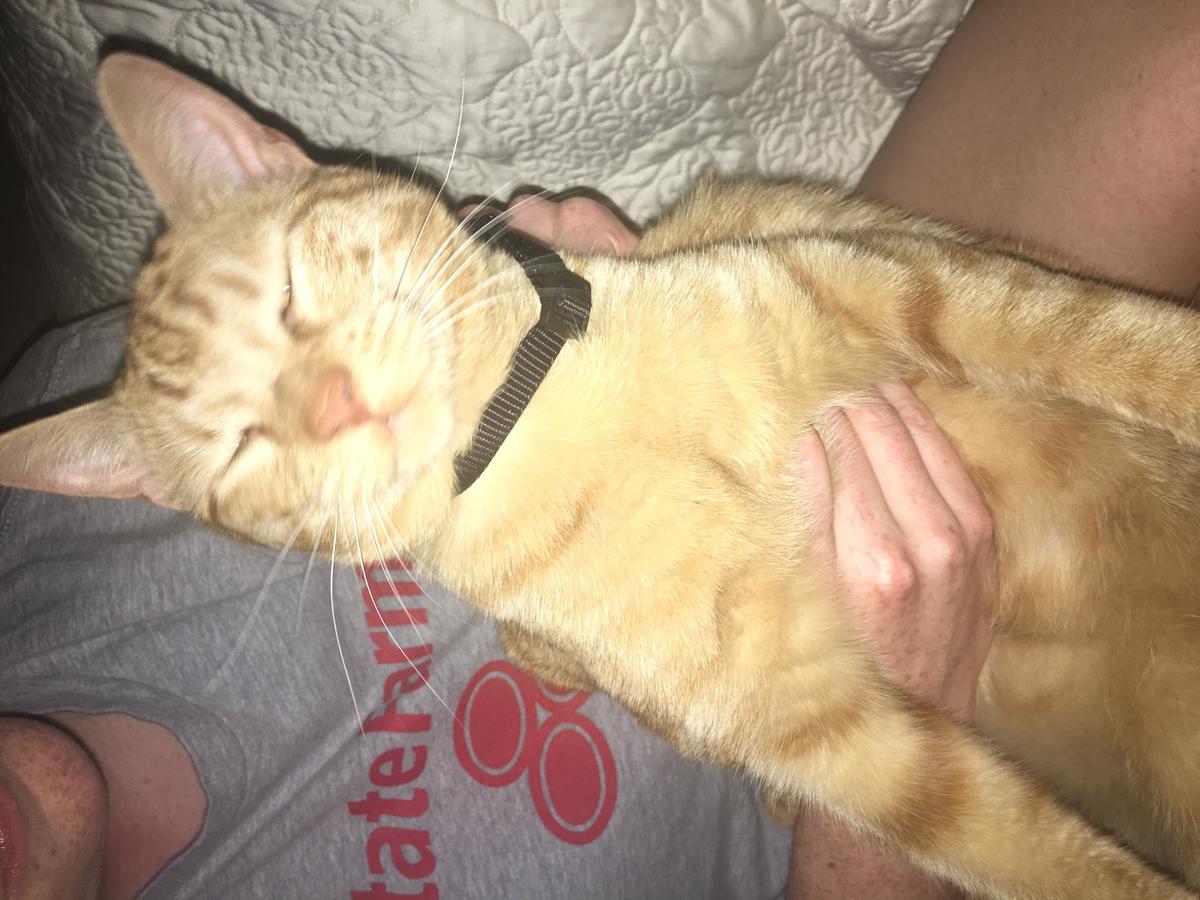
The cat we tested the ”Tile collar” on, had no problem wearing it.
• What were the limitations and opportunities for public participation in the original project? How has your adaptation altered those limitations and opportunities? (10 pts)
Original opportunities: A large amount of data were gathered in completing this project. After the data was gathered, it was as simple as downloading and uploading to website. There was no need for manual data collection and compilation.
Original limitations: If you cannot rent one out, then the GPS unit is $60. Cat harness acclimation period of at least 2 days. Confusing process of setting up the GPS tracker to collect the right amount of data.
TILE opportunities: It was an engaging experience for participants (have to do the work to find cat locations). The Tile is less expensive and more user friendly compare to the GPS tracker. It was an instant tracking of the cat due to small size and no acclimation period. We tested the tracking process and confirmed that it worked.
TILE limitations: Increased work load. Data collected can substantially lower depending on when you decide to check the application. The data we ended up collecting had to be manually projected onto a map, in order to give the researchers their information. We were unable to collect data at night due to participants being asleep and no autonomous application to gather data
Time limitations: We were unable to collect data from the actual tracking of the cat due to time constraint.
• Would future participants be able to more easily ask questions about the design of the project itself and the information that it is collecting? Has the nature of the project changed? If so, evaluate this change. Does it collect more data? Different data? Does it make the project better or worse? Is it more accessible/less accessible? (10 pts)
Future participants will ask more questions about the design of the project. Participants will potentialy ask if the project will be effective and efficient as the original device. The nature of the project did not change. The Tile is collecting the data from the cat as the original device. However, data collected has to have more work done on it by the participant than before. We believe this is a more accessible version at the cost of autonomy of the original hardware. Data collected is also less due to the fact that it is manually tracked over a period and participants will most likely not be able to collect data while asleep.
• Lessons learned? Take-aways? Conclusions? (10 pts)
Overall the project went well for how we started. Not being able to create or gather data the way we wanted or modify the TILE was challenging, but we were able to get the data we needed to complete the project. Luckily, one of our group members knew how to create a 3D design that we were able to print and use it as the TILE holder. One of the take-aways is to learn the basics of planning out and executing as a team to gather, build, and compile the necessary components and data. Trying to adapt current market products to certain citizen science projects can be difficult if you need specific data. It could take a lot of time to create a project like this and be successful. Once a project is successfully finished, you could feel you can create anything cheaper or enhance other projects. We were successful with the Tile, and we are collecting the same data as the original for a cheaper price.